Hydrological Atlas of Switzerland – Plate 1.2
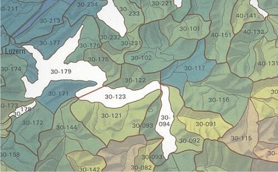
For the Atlas, a spatial system of catchments comprising three levels was developed thus allowing a direct comparison of catchments within one level, and a linking one below the other of the catchments in all three levels by means of aggregation or disaggregation. Large catchments (river basins) usually covering an area of multiple 1000 km² are the top level. The water balance basins including catchments of 100 to 150 km², are a result of subdividing the river basins. The small catchments (30 to 50 km²) make up the lowest level of the spatial system.
In digital form:
Plate of the Atlas as pdf (26028kb)
Explanatory text (taken without changes from the Hydrological Atlas)
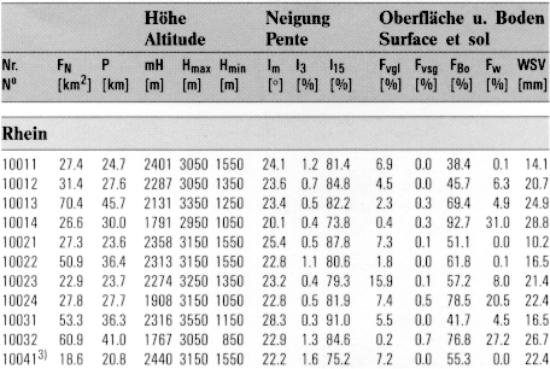
Table «Kenngrössen kleiner Einzugsgebiete»
Georeferenziertes Shapefile (.zip) - 1691kb
Top (of page)