Hydrological Atlas of Switzerland – Plate 5.3
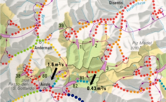
In Switzerland, many surface waters are influenced by a variety of both construction and water management actions. Among the significant quantitative changes in the water balance are the impacts resulting from hydro-electric power production, domestic water supply and lake control. Shown by a six-part gradation, the main emphasis of the map is the influence on rivers by power stations with a maximum possible generator capacity of at least 300 kw. The degree of influence is described as a percentage of the mean natural annual discharge.
In digital form:
Plate of the Atlas as pdf (26179kb)
Explanatory text (taken without changes from the Hydrological Atlas)
Table «Stauseen und Ausgleichsbecken (Fläche > 0.1 km²)»
Top (of page)