Hydrological Atlas of Switzerland – Plate 5.6
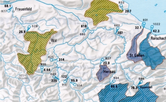
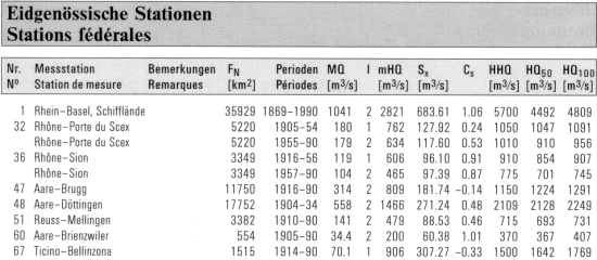
This plate shows extreme flood discharge peaks, statistical characteristics and flood frequency for selected catchments throughout Switzerland. All measuring stations from which data was used are shown on the map. Apart from general information about the stations, the table contains the following statistical values: mean annual discharge, mean value, standard deviation and skewness of annual flood peaks, the highest flood peak observed and the 50-year and 100-year flood peak values.
In digital form:
Plate of the Atlas as pdf (28782kb)
Explanatory text (taken without changes from the Hydrological Atlas)
Table «Verzeichnis der Kennwerte»
Top (of page)