Hydrological Atlas of Switzerland – Plate 3.11

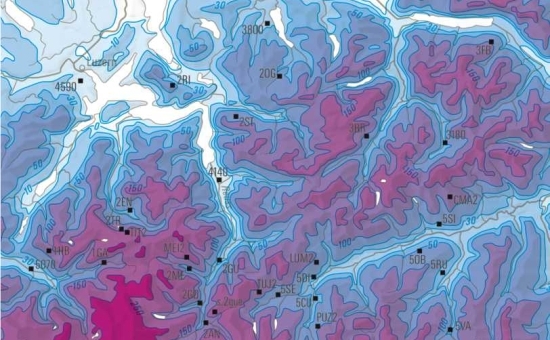

Large parts of Switzerland are covered by a solid layer of snow for many months. The thickness of this snow cover depends on various factors such as season or altitude, which means that it can vary considerably within a short distance and between one region and another.
The depth of the snow cover is measured and analysed at around 300 stations. These spot measurements are then extrapolated to larger areas to estimate the depth of snow in places where no measurements are available. Maps of snow depth are an important basis for avalanche warnings, although they are also important for tourism in relation to snow reliability, for setting up hydrological models and for nivo-climatic studies.
In digital form:
Plate of the Atlas as pdf (8117kb)
Explanatory text (taken without changes from the Hydrological Atlas)
Table «Mittlere an den Stationen beobachtete Schneehöhen 1983 – 2002»
Georeferenziertes Shapefile (.zip) - 56364kb
Top (of page)