Hydrological Atlas of Switzerland – Plate 5.1²

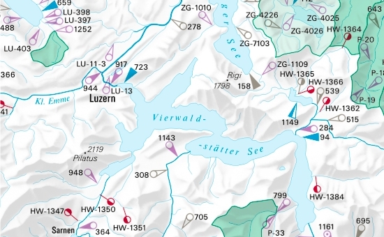
The hydrometric networks in Switzerland include measuring stations for water-levels and discharge run by various operators. At present the federal measuring network is maintained by the Swiss National Hydrological Survey (SNHS), which is part of the Federal Office for Water and Geology. In addition various cantons have set up their own measuring networks. A number of individual hydrometric stations have also been established by «private» organisations, for example by hydro-electric power stations or university departments. The stations are unambiguously identified by the numbers on the map and in the tables.
In digital form:
Plate of the Atlas as pdf (Edition 1992 / 39956kb)
Plate of the Atlas as pdf (Edition 2002 / 7939kb)
Explanatory text (taken without changes from the Hydrological Atlas)
Table «Eidgenössische Stationen»
Table «Eidgenössische Hochwassergrenzwertpegel»
Table «Kantonale Stationen»
Table «Private Stationen»
Top (of page)