Hydrological Atlas of Switzerland – Plate 8.6
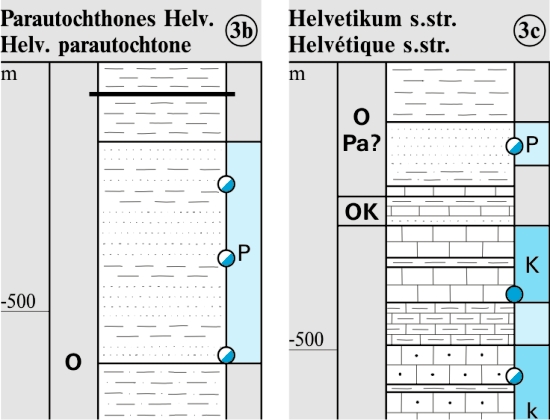
The rate of water movement through a rock or soil (permeability) depends on its lithology and tectonic setting. A high permeability is one of the prerequisites for the development of a productive groundwater supply. The recharge of groundwater resources occurs through the seepage of precipitation and infiltration of surface water.
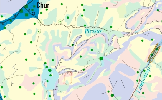
The «Groundwater Resources» map (1:500 000) is a further development of the 1967 edit ion of the Hydrogeological Map of Switzerland. The principal contents of this map have been established from numerous data creating a nation wide representation of near surface groundwater resources and their yields .
In digital form:
Plate of the Atlas as pdf (24670kb)
Explanatory text (taken without changes from the Hydrological Atlas)
Top (of page)