Hydrological Atlas of Switzerland – Plate 6.5
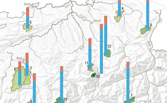

Knowledge of the characteristics of the elements that make up the water cycle (precipitation, runoff, evaporation and changes in the volume of water retained) in medium-sized catchments that are not affected by anthropological factors is extremely important, since their water balance is a direct reflection of the climatic conditions and thus clear indicator of any possible changes in these conditions.
In digital form:
Plate of the Atlas as pdf (5636kb)
Explanatory text (taken without changes from the Hydrological Atlas)
Table «Summe der mittleren jährlichen Abfluss- und Verdunstungshöhe sowie Kenngrössen der Einzugsgebiete»
Top (of page)